twc-006 / A study by Syafril · not client work

Wayfinder: Wayfinder

A planning application with three illustrative routes, a topographic diagram, calculated elevation metrics, checkpoint states and a text export. All route data is synthetic and clearly labeled, not navigation guidance.

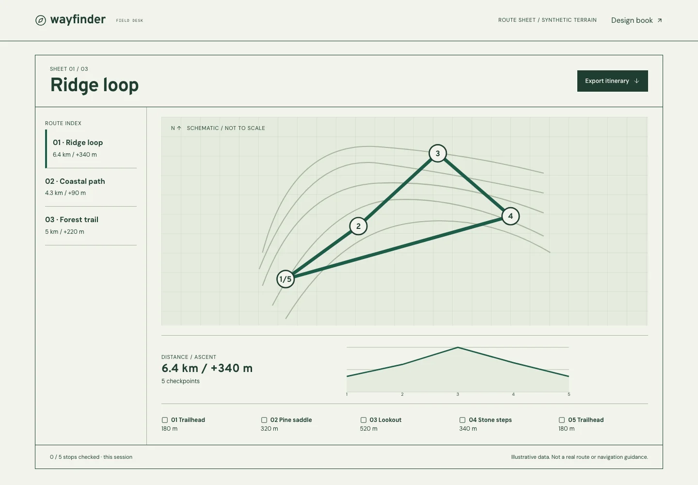
Actual desktop capture of the Wayfinder demonstration.

At a glance

Headline type
Overpass
Reading type
DM Sans
Try this interaction
Select a route, inspect its elevation, check the stops and export a text itinerary.
Field paper#f2f4ec
Forest ink#203d32
Route green#1e5b49
A schematic of the implemented composition.

WHAT IS HERE / WHAT COMES NEXT

Know what you are choosing.

Outdoor and planning interfaces that benefit from linked visual and numeric views.

Working in this demo

  • Three synthetic routes with computed distance/ascent, linked profile, checkpoints and real text export.
  • A route-sheet index with search, pins, a list export, local display settings and account-form UI.

This theme includes dashboard, login/recovery UI, settings, interface states and its own component book. Registration UI is provided where it fits the theme.
Production integrations to discuss

  • Real maps, geolocation, verified routing, saved trips and production account services.

Account forms validate sample values locally. They do not authenticate, create users or deliver email. Dashboard records are authored examples.

A limit to plan around

Routes are synthetic interface examples. They are not navigation instructions, terrain advice or live geographic data.

Delivery & customization

Page scope, brand assets, content, handover, hosting, costs and support are discussed in a consultation before work begins. The demo is a reference for that conversation.

Prepare a brief for this direction

The idea

Put an application workflow inside the collection. Select a route, inspect its profile, mark the stops and take a text itinerary away. The work happens in the interface rather than in a promotional headline.

Visual language

Field-paper surfaces, forest ink, contour lines and hairline rules. One folded route sheet: an index fold, the map in the middle and the elevation profile along the bottom edge; numbers on the map, stops and profile refer to each other.

Typography

Overpass, an open cousin of highway sign lettering, titles the route like a road sign. DM Sans keeps dense route labels readable; IBM Plex Mono marks coordinates, small identifiers and metric units.

Layout & composition

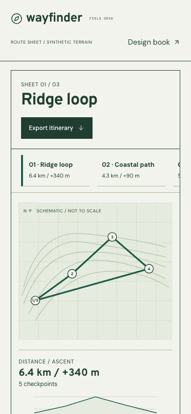
The selected route titles the sheet, with the itinerary export beside it. The route index sits on the left fold beside the schematic map; calculated distance/ascent, the profile and numbered stops follow along the bottom edge. On phones: name and route choice, then map, profile and checklist.

Motion & interaction

Motion crossfades the selected route while keeping the map frame stable. Checkpoints update immediately. Reduced motion shortens the fade and does not alter route calculations or available actions.

Under the surface

Static typed route data drives the diagram, elevation profile, metrics and plain-text export. Totals are calculated from the selected route. No map service, live location, weather API or backend is connected.

Designed for everyone

Routes use labeled buttons in an index group; checkpoints expose pressed state. Diagram and elevation chart have meaningful text alternatives, with all elevations also available in the checkpoint list. The export is a real text file.

Inside the experience

  • Three selectable route studies
  • Computed distance and ascent
  • Diagram and elevation profile
  • Checkpoint checklist and real text export

A good fit for

  • Planning and mapping applications
  • Data-rich workspaces and dashboards

Across screens

Actual desktop capture of the Wayfinder demonstration.
Actual mobile capture of the Wayfinder demonstration.

A different perspective